
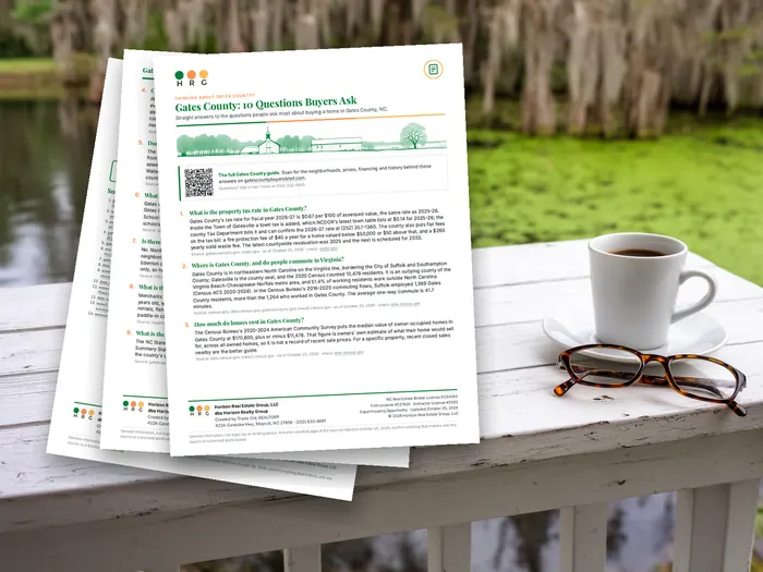


Gates County covers roughly 340 square miles — about 218,000 acres — and holds 10,478 people.1 The Census Bureau flags the entire county rural. There are 11,200 or so tax parcels in it.2
Those numbers describe a place where land is the asset and buildings are incidental to it. If you are shopping here the way you would shop a subdivision — square footage, finishes, schools, resale — you will be confused by half of what you see. This chapter is about the other framework.
What the agriculture data actually says
The 2022 Census of Agriculture is the best public picture of who owns and works this county's ground, and it contains two surprises.3
| Measure | Gates County, 2022 | Change since 2017 |
|---|---|---|
| Farms | 122 | Down 13% |
| Land in farms | 71,866 acres | — |
| Average farm size | 589 acres | Up 43% |
| Market value of products sold | $137,377,000 | Up 88% |
| Livestock and poultry share of sales | 72% | — |
| Poultry and eggs | $84,762,000 | — |
| Cotton and cottonseed | $15,028,000 — 8th in North Carolina | — |
| Family farms | 91% | — |
Surprise one: this is a poultry county, not a row-crop county. Livestock and poultry make up 72% of agricultural sales, with poultry and eggs alone at $84.8 million and a broiler inventory over two million birds. Crops are the minority of the money even though soybeans (21,563 acres) and cotton (15,395 acres) dominate the acreage.
Surprise two: fewer farms, much bigger farms, far more money. Farm count fell 13% while average size rose 43% and total sales rose 88%. That is consolidation, and it has a direct consequence for a buyer: the marginal buyer of a mid-sized tract in this county is frequently an adjoining operator with a specific agronomic reason to want it, not a household looking for a homesite. You are sometimes bidding against a business case, not against another family.
Read the land-use split before you assume "timber"
Of land in farms, the 2022 census counts 53,172 acres of cropland, 13,932 acres of woodland and 1,315 acres of pasture. Woodland inside farm units is a minority of farm acreage here. Plenty of timber sits outside farm units too — the census only counts land in farms — but do not walk in assuming every wooded tract is a managed timber investment. Ask what has been cut, when, and what the reforestation plan is.
Present-use value: the biggest number on the tax card, and the biggest trap at closing
North Carolina taxes qualifying agricultural, horticultural and forestland at its use value rather than market value, with the difference deferred rather than forgiven. On a large tract the annual saving is substantial. The deferral is also a liability that travels with the land, and it is where acreage buyers get hurt.
Qualifying, for forestland specifically
| Test | Forestland | Note |
|---|---|---|
| Minimum acreage | 20 acres in actual production, not included in a farm unit | Agricultural is 10 acres, horticultural 5. The minimum applies to the initial qualifying tract. |
| Income test | None | Agricultural and horticultural land must average $1,000 gross income over the three preceding years. Forestland has no income test at all. |
| Management | A written sound forest management plan for the production and sale of forest products | Must be written — forestland has no alternative-factor menu. A copy is submitted with the application, and the land must comply as of January 1. |
| Ownership | The owner's residence, or owned by the owner or a relative for the four years preceding January 1, or received from a qualifying entity or trust | This is the rule that catches new buyers. See below. |
The plan may be prepared by a consulting forester, an N.C. Forest Service forester, or the owner if suitably skilled. The primary objective has to be commercial timber production.4
The deferred-tax exposure is four years, not three
This is the single most misstated number in North Carolina land transactions
The statute says deferred taxes for the three preceding fiscal years become due on a disqualifying event. But a separate provision re-bills the year of disqualification itself as if the property had never been classified. That is four tax years of exposure, and the Department of Revenue's own program guide calls it four years. Anyone who tells you "three years of back taxes" is understating your liability by a full year.5
Interest is not a flat penalty and does not run from the disqualification date. Each year's slice accrues as if it had been payable when it originally came due — so the oldest year carries the most interest. There is also a 10% penalty of deferred taxes plus interest, per listing period, for failing to notify the assessor of a disqualifying change.
And it does not transfer automatically
This is the practical closing risk. Present-use value classification does not survive a sale on its own. A new owner must file — on Form AV-5, within 60 days of the transfer — and accept the deferred-tax liability in writing. Miss the window and the classification is lost, which triggers the four years described above, payable by whoever owns the land when the bill lands.5
So on any listing carrying present-use value, three questions belong in the offer, not in a post-closing email:
- What is the deferred-tax balance today? The county assessor can state it. Get the number before you price the tract.
- Do you intend to continue the classification, and do you qualify? The four-year ownership rule has exceptions for continued use and for expanding an existing farm unit — but they are exceptions, and whether you fit one is a question for the assessor before contract.
- Who pays if the classification is lost? Put it in writing. Custom is not a contract term.
Where deferred taxes are not billed
There are real exceptions: enrollment in the Conservation Reserve Program extinguishes the lien; conveyance to a nonprofit or government body at or below use value triggers nothing; qualifying conservation easements, wildlife-conservation land and site-infrastructure land carry the deferral forward as a lien rather than billing it. Condemnation is not an exemption — the taxes are billed — though a natural person whose land is taken in fee simple, who also owns contiguous land in active production, may be entitled to reimbursement from the condemnor.5
No per-acre use value is published on this site
Use values are set by each county's Schedule of Values. The Use-Value Advisory Board's manual is recommended, not binding. North Carolina fixes the forestland capitalization rate at 9% by statute, and unlike agricultural land there is no statutory per-acre ceiling on forestland value. Gates County's own per-acre forestland use value is not published here — get it from the county assessor for the specific tract, because it is the number that determines your actual annual bill.
The zoning rule almost nobody mentions to acreage buyers
Gates County adopted a countywide zoning ordinance on June 16, 2021, last amended March 16, 2022. Every acre in the county's planning jurisdiction sits in one of eight districts: A-1 Agricultural, R-1 Residential, RMH-1 Residential Manufactured Home, RMF Multi-Family, C-1 Commercial, I-1 Industrial, O&I Office and Institutional, and individually designated Planned Developments.6
Most of the county's rural land is A-1. And A-1 carries a restriction that changes the arithmetic on any tract bought with a subdivision plan:
§ 155.108(C) — A-1 subdivisions limited
"Other than subdivisions exempted from Chapter 152, Subdivisions, transfer subdivisions, and expedited subdivisions, divisions of land for the establishment of residential land uses are prohibited within the A-1 district and shall require an amendment to the official zoning map."6
Read plainly: creating residential lots out of agricultural-district land generally requires a rezoning unless your split qualifies as exempt, a transfer subdivision, or an expedited subdivision. A rezoning is a public process with a public outcome, and no one can promise you one. If your purchase math depends on carving four homesites out of a forty-acre tract, get a written read from Planning & Development before you go under contract, not after.
The dimensional standards, in brief
| District | Minimum lot size | Min. lot width | Front / side / rear | Max height |
|---|---|---|---|---|
| A-1 Agricultural | As required by the health authority, but not less than 1 acre | 175 ft | 40 / 20 / 20 ft | 35 ft |
| R-1 Residential | 1 acre, or as required by the health authority | 175 ft | 40 / 20 / 20 ft | 35 ft |
| RMH-1 Manufactured Home | 1 acre or health-authority requirement; minimum average lot depth 200 ft | 175 ft | 40 / 20 / 20 ft | 35 ft |
| C-1 Commercial | 1 acre, or as required by the health authority | 175 ft | 30 / 20 / 20 ft | 35 ft |
| I-1 Industrial | 2 acres, or as required by the health authority | 175 ft | 40 / 20 / 20 ft | 56 ft |
Two things to notice. First, every minimum lot size defers to the health authority — the zoning minimum is a floor, and the soil determines the real one. That is the subject of the septic chapter, and it is why the soil evaluation, not the survey, is the gating document on raw land here.
Second, there is a universal rule the district tables carry as a footnote: "All lots shall maintain a minimum width of at least 125 linear feet at any buildable location on the lot." Long, narrow flag-shaped tracts — common where family land has been divided informally over generations — can fail that test even when they pass on total acreage.
Lots of record lawfully established before June 16, 2021 that do not meet the current dimensional standards may still be developed with one single-family home. If a tract predates the ordinance, its rights may be better than the table suggests. Confirm the recording date.
What to do with all of this
The sequence that keeps acreage buyers out of trouble here is unglamorous and it is always the same:
- Pull the tax card. Present-use value status, deferred balance, drainage district membership, and the assessed value coming out of the 2025 revaluation.
- Call Planning & Development with the parcel number. Zoning district, and whether what you intend is permitted without a map amendment.
- Get a soil evaluation before the due-diligence period expires, not after. Chapter 3.
- Walk the boundary with the survey and the aerial. Look for standing water, ditching, and where the wet ground starts. Chapter 2.
- Then talk about price.
- 2020 Decennial Census: Gates County population 10,478; land area 340.6 square miles; the Census Bureau's urban/rural flag for the county is "R." U.S. Census Bureau TIGERweb county data, GEOID 37073. Acreage figure derived from the published square mileage. ↩
- Gates County Tax Administration reports maintaining property records on approximately 11,200 parcels. gatescountync.gov/tax-administration, (252) 357-1360. ↩
- USDA National Agricultural Statistics Service, 2022 Census of Agriculture, County Profile: Gates County, North Carolina, reference year 2022. nass.usda.gov. Gates County ranks 39th of 100 North Carolina counties in total agricultural sales. ↩
- N.C.G.S. § 105-277.3(a) and (g), and the North Carolina Department of Revenue Present-Use Value Program Guide, August 2023 edition. Note that NCDOR's landing page has also served a stale January 1, 2019 copy — use the 2023 edition. The guide states that forestland "only has to meet three tests since the income test is not applied to forestland." ↩
- N.C.G.S. § 105-277.4(c) (deferred taxes for the three preceding fiscal years), § 105-277.1F(b) (the year of disqualification computed as if the property had not been classified, and interest accruing as if each year had been payable when originally due), § 105-277.3(b) and (b1) (ownership and the four-year rule), § 105-277.2(4) (eligible owners), § 105-277.4(d) and (d1) and § 105-277.3(d1)–(d3) (exceptions), and N.C.G.S. § 40A-6 / § 136-121.1 (condemnation reimbursement). Filing deadlines and Form AV-5 per the NCDOR guide. "Rollback" is not a statutory term in North Carolina. The specific interest rate schedule in the guide's worked example was not independently checked against N.C.G.S. § 105-360, and the statutory citation for the 10% notification penalty was not confirmed. ↩
- Gates County Code of Ordinances, Title XV Land Usage, Chapter 155 Zoning, adopted June 16, 2021, last amended March 16, 2022. District list at § 155.107; A-1 subdivision limitation at § 155.108(C); dimensional standards from each district's Dimensional Standards Table. Gates County Planning & Development, 252 NC 37 S, PO Box 411, Gatesville, NC 27938, (252) 357-0122; Director Lisa Cherry. ↩