

Merchants Millpond is a 760-acre pond in Gates County, about ten miles south of the Virginia line, and the center of the state park that carries its name1. It is a made landscape: a mill dam on a blackwater creek, held in place for more than two centuries, behind which a forest of cypress and tupelo grew up in the water.
Before 1811 Bennetts Creek & Hunters Millpond
The pond sits on Bennetts Creek, which forms where Duke, Harrell and Raynor swamps meet in the middle of the county and runs to the Chowan River. Powell's North Carolina Gazetteer says the creek is named for Richard Bennett, governor of Virginia in the 1650s2. The state's 1978 master plan for the park described the creek as slow and dark, passing through a narrow bald cypress swamp, Lassiter Swamp, into an older second-growth cypress and gum swamp, and ending in the pond, with the land rising sharply twenty to thirty feet from the water's edge on both sides3.
Merchants was not the first mill on the creek. Farther up, at the head of Bennetts Creek near present-day Sunbury, Hunters Millpond was built before 1720, according to the 1978 plan, and its dam was destroyed in 1922 when Highway 32 was built4. The park's 2017 general management plan dates Hunters Millpond to the early 1700s and says it was built to process and market the region's crops5.
1811–1910 Norfleet's, Then Williams's
The 1978 plan credits Kincken Norfleet with building the dam in 1811, which is why the water was first called Norfleets Millpond. Corn was first ground at the new gristmill in 1812, and a wheat mill and a sawmill were built that year too. In 1856 Norfleet sold the mill to Daniel and H. C. Williams; when Rufus Williams joined them as a partner it became Williams Millpond, and it later passed to LeRoy Smith, with N. J. Riddick running it4. The 2017 management plan and the state park system's own entry on NCpedia also give 1811 and the Norfleet name56.
1879–1940 The Merchants' Mill
By around 1900, the 1978 plan says, the mill was the largest in Gates County and its chief trading place. A store opened beside it so farmers could shop while their corn and wheat were ground, and the pond took its name from that trade. People came to picnic, fish and court on its banks, and, the plan adds, apple brandy was supposedly made at a still nearby and served at the back of the store4.
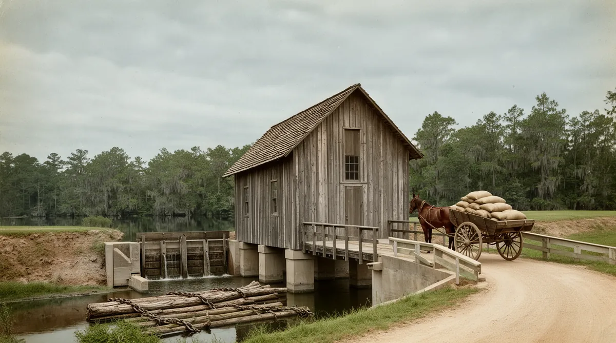
The plan preserves a close description of the mill as it stood about 1908, when two gristmills were running most of the time. The mill house was a frame building of wide, weathered boards, roughly 25 by 30 feet, with a wood-shingled roof, built over the water on cement pilings. Planks beside it made a covered bridge with a long bench for customers waiting their turn. On the east side of what is now SR 1400, a dam held the pond back, and seven wooden gates, each four by six feet, let water down onto the wheel. The miller kept a share of each farmer's grain as his toll, possibly three quarts from every bushel. When a flash flood damaged the dam, neighbors turned out to repair it, and each spring they gathered to recut the grooves in the millstones and held a fish fry8.
The place had its own post office, and the sources do not agree on its dates. The North Carolina Postal History Society's catalog, built from the appointment records, lists Rufus J. Williams as the first postmaster on May 2, 1879, shows the office closing in 1898 and reopening that May as Merchants, renamed Merchant Mills in 1902, and finally discontinued on June 30, 1913, with mail sent to Gatesville9. Powell's gazetteer also gives 1879 to 191310. The 1978 park plan dates the office to about 1910 and its closing to 1915, and the 2017 plan says early 1880s to about 1915115. The postal record is the strongest of the four.
Around 1910, by the 1978 plan's account, Charles Marmaduke Lawrence of Gatesville bought the mill, the sawmill, the store and the pond; some credited him with starting the store. The mill ran until shortly before the Second World War, and its last miller was probably Gene Lassiter11.
1944–1978 From Development Plan to Park
The pond came close to becoming something else. Lawrence sold it in 1944 to H. P. Foxhall of Virginia, and in 1951 it went to B. Howell of West Virginia. According to the 1978 plan, both men apparently had development in mind for the site, and neither scheme went anywhere. More than a decade later A. B. Coleman of Moyock bought the property11.
In June 1973 Coleman and members of his family gave the millpond and adjoining land to the state's Division of Parks and Recreation, and the state park dates its founding to that year. State sources put the Coleman gift at 919 acres. In December 1973 The Nature Conservancy deeded 925 acres of woodland on the north side of the pond to the state1156. The 1978 plan notes that much of that woodland had recently been clear-cut12 and, in its wildlife section, mentions deer hunting on "the former Georgia-Pacific property" before the company gave it to the state; it does not say outright whether that was the same tract13.
Two buyers had plans to develop the pond. The third gave it to the state.
The master plan the state issued on February 20, 1978, counted 1,947.1 acres in the park. It set protecting the pond and Lassiter Swamp as the first goal, called for buying the undisturbed swamp upstream in phases, and recommended that Lassiter, Duke and Raynor swamps and Bennetts Creek be designated conservation zones under the state's Coastal Area Management Act14. It also warned that wet soils and a high water table severely limited where anything could be built15.
Natural History Cypress, Tupelo & Duckweed
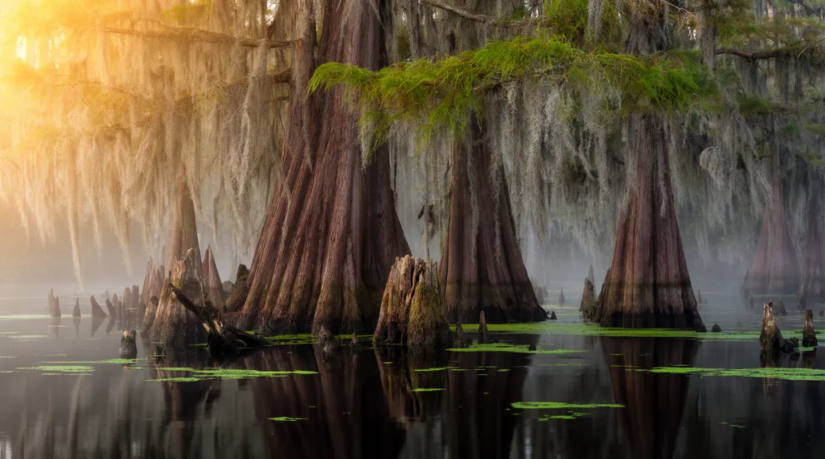
The 1978 plan described the pond as an unusual meeting of a coastal millpond and a southern swamp forest. Bald cypress (Taxodium distichum) and water tupelo, which the plan calls water gum (Nyssa aquatica), dominate the water, with remnants of older, larger trees most evident in an area known as "the cathedral." Huge stumps are scattered across the pond, and resurrection fern and Spanish moss cover most of the trees. Duckweed blankets many of the shallow coves, alongside spatterdock, pondweed, tapegrass and water shield, and the plan notes that dwarf duckweed, the smallest known flowering plant, grows there in small amounts16. The park system's own description adds that duckweeds and water fern often lay a shifting red and green layer across the surface17.
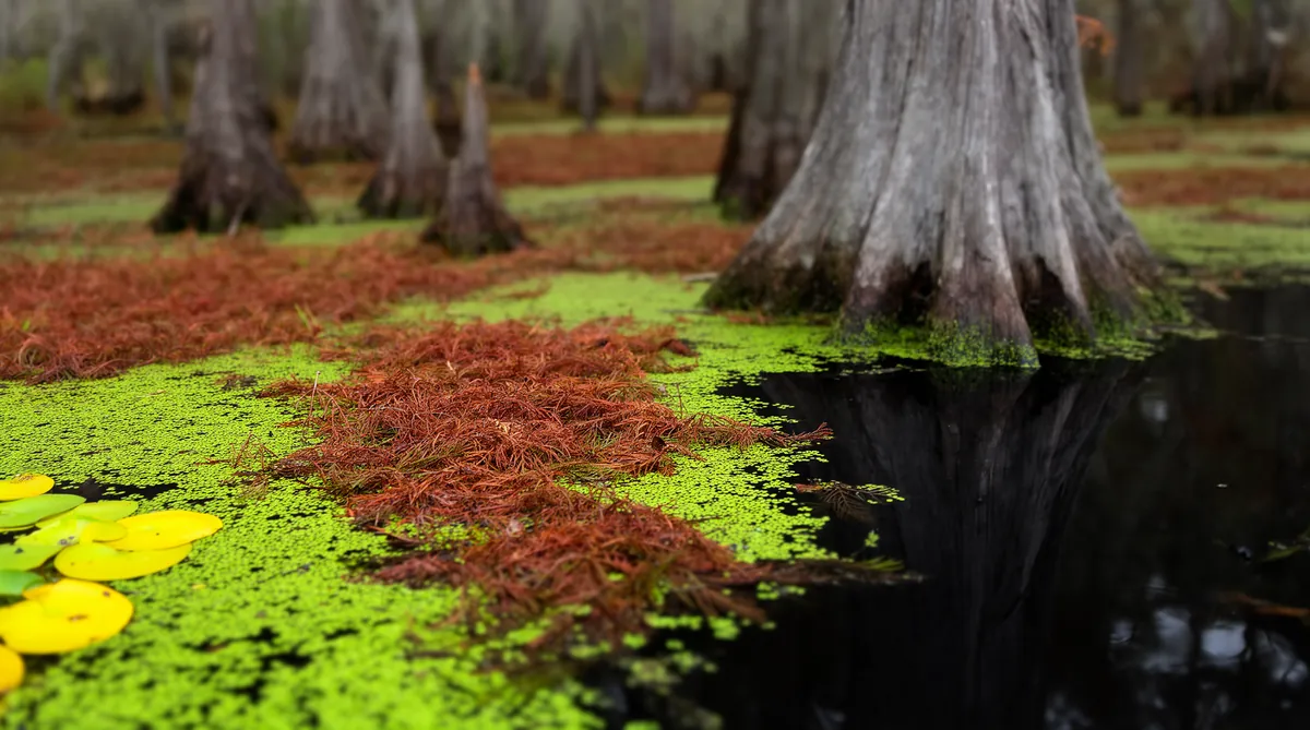
At the upper end of the pond is Lassiter Swamp. The 1978 plan counted thirty to forty bald cypress there averaging five feet across and more than a hundred feet tall, and described a transition zone of second-growth cypress and tupelo affectionately called the "enchanted forest," where the tupelo trunks had swollen into burls and twisted shapes. The plan said mistletoe was believed to cause the distortion1216. It also recorded a loss: a 148-acre stretch on the south side of Lassiter Swamp, until the year before the main remnant of a virgin cypress swamp, had just been logged, though the largest trees were left standing16.
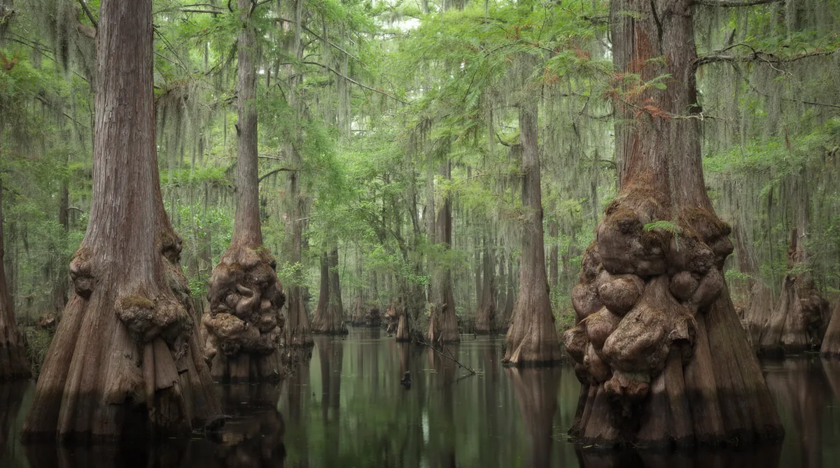
Those trees are old. In 2019 the U.S. Geological Survey reported that tree-ring analysis at Lassiter Swamp shows cypress has grown on the site for at least 500 years, and that USGS, Duke University and East Carolina University scientists were working with students from a Hertford County high school on sediment cores to trace the swamp's plants and fires back thousands of years18. The 2017 management plan notes that about 1,900 acres of the park are designated the Merchants Millpond Registered Natural Heritage Area, and that many plants here grow at or near the edge of their range19.
The wildlife list is long. The park system's description counts more than 200 bird species recorded in the park, from egrets and hooded mergansers to prothonotary warblers, along with frogs, turtles, water snakes including the venomous cottonmouth, beaver, river otter, mink and bobcat, and two ancient fish of blackwater, the longnose gar and the bowfin17. NC State Parks also says visitors have spotted American alligators here, at the northernmost point of their range1.
The pond is managed, not wild. In 1978 the Wildlife Resources Commission lowered the water by fourteen inches each year from November to mid-March to hold down weeds and small fish13, and the plan traced most of the pond's nutrients to fertilizer running off the farms along Bennetts Creek12. Whether the annual drawdown continues is a question for the park office; current park documents do not say.
2008–2026 The Park Today
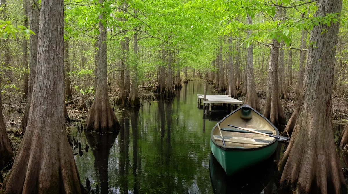
NC State Parks lists 10 miles of hiking trails and 5 miles of biking trails at the park, along with camping, paddling, fishing and boat rentals1. A visitor center opened in 2008. The 2017 management plan describes marked paddle trails on the pond and down Bennetts Creek, including a 5.7-mile paddle trail toward Gatesville, and it proposed upgrades to the campgrounds and a longer Coleman Trail along the pond's south edge with boardwalks across ground that floods20. In May 2026 the state named a longtime ranger, Jeffrey Turner, park superintendent, citing his prescribed-fire work and noting a campground renovation nearing completion and recent land purchases. The superintendent also oversees the Chowan Swamp and Salmon Creek state natural areas21.
As of October 24, 2026, the park's page lists no fee for day use except boat rentals, with fees for camping, some event permits and reservations. Park hours run from 8 a.m. to 6 p.m. in November through February, to 8 p.m. in March through May and in September and October, and to 9 p.m. in June through August; the park closes on Christmas Day. The visitor center is open 8 a.m. to 5 p.m. from November to February and to 6:30 p.m. from March to October. Check the NC State Parks page before you go; hours and fees change23.
For Buyers Living Near the Park
For anyone buying in the middle of Gates County, the park is the largest neighbor there is, and a few facts from its own planning documents are worth knowing.
First, the park's purpose, in its own plan, is to protect the pond, the swamp and the wildlife that need large tracts of wild land19, and it has been adding land at its edges for decades as money allows, like the 55.81 acres on Bennetts Creek bought in 2008 with Parks and Recreation Trust Fund money22. The 2017 plan maps land it would like to protect for access and for the Bennetts Creek watershed20, so an owner along the creek could someday be asked whether they would sell. Second, the park manages its woods with prescribed fire, which the state highlighted when it named the new superintendent in 202621; neighbors should expect planned burns and some smoke.
Third, the ground around the pond and the creek is wet ground. The 1978 plan found that wet soils and a high water table severely limited building, and the 2017 plan called for boardwalks where its own trails cross wetland and floodplain1520. The same is true of private land along Bennetts Creek and its swamps. Before you make an offer on a parcel near the creek, look it up on the state's flood map viewer24, then read the site's swamp-edge chapter on wetlands rules and the wells and septic chapter on what a soil evaluation decides. Finally, a "Gatesville" mailing address near the park does not mean the parcel is in the Town of Gatesville; the park itself uses a Gatesville address several miles from the town1. The Gatesville page explains why that matters, and the waterfront listings are the place to watch for creek and pond frontage.
Primary Sources & Further Reading
Merchants Millpond State Park Master Plan (1978)
The state's first plan for the park, with the mill's history, the land deals and a survey of the plants and animals.
General Management Plan (2017)
NC State Parks' current planning document: history, trails, land protection and proposed projects.
NC State Parks: Merchants Millpond
Hours, fees, camping, trail maps and the park's own description.
The mill-era details on this page come mostly from the 1978 master plan, which drew on interviews and local accounts it does not always identify; treat its color, such as the apple brandy, as recollection rather than record. Dates the plan gives are checked against postal records and later state documents wherever possible, and conflicts are shown in the text.
- NC State Parks, "Merchants Millpond State Park," ncparks.gov, read October 24, 2026: "Located in Gates County 10 miles south of North Carolina's northeastern border with Virginia ... centers on a 760-acre millpond"; address 176 Millpond Road, Gatesville; the activities list (hiking 10 miles, biking 5 miles); the alligator range statement. ↩
- William S. Powell, The North Carolina Gazetteer, entry "Bennetts Creek," NCpedia, ncpedia.org/gazetteer/b?page=88. ↩
- N.C. Department of Natural Resources and Community Development, Division of Parks and Recreation, Merchants Millpond State Park Master Plan (dated February 20, 1978), "Merchants Millpond," p. 1, archive.org. ↩
- 1978 Master Plan, as in note 3, "Merchants Millpond History," pp. 1–4 (Hunters Millpond; Kincken Norfleet and the 1811 dam; the 1856 sale and later owners; the mill as the county's chief trading center; the store and the apple brandy). ↩
- N.C. Department of Natural and Cultural Resources, Division of Parks and Recreation, Merchants Millpond State Park General Management Plan (Coastal Region, May 2017), section II, "History," pp. 3–4, ncparks.gov (PDF). ↩
- "Merchants Millpond State Park," NCpedia, content provided by the N.C. Division of Parks and Recreation (2015), "Park History," ncpedia.org. The same entry gives "Size: 3,447 acres" in its summary and "more than 3,250 acres" in its text. ↩
- William S. Powell, The North Carolina Gazetteer, entry "Merchants Millpond": "Formed about 1857 by Rufus Williams and known as Williams Millpond until about 1910, when it was sold. The new owner built a store there, hence the name. Approx. 3 mi. long. Max. depth 8 ft.," NCpedia, ncpedia.org/gazetteer/m?page=49. ↩
- 1978 Master Plan, as in note 3, "Merchants Millpond History," pp. 1–4 (the mill house about 1908, quoting an earlier description; the dam, gates, toll and community repairs). ↩
- R. F. Winter, North Carolina Postmark Catalog: Gates County, North Carolina Postal History Society (August 15, 2024), entry "Merchant Mills, Merchants," ncpostalhistory.com (PDF). ↩
- Powell, North Carolina Gazetteer, entry "Merchants": "community in NE Gates County served by post office, 1879–1913. Known as Merchants Mills after 1902," NCpedia, as in note 7. ↩
- 1978 Master Plan, as in note 3, "Merchants Millpond History," pp. 1–4 (Lawrence about 1910; the "Merchants Mill" post office; Foxhall in 1944, Howell in 1951; Coleman; the June and December 1973 conveyances). ↩
- 1978 Master Plan, as in note 3, "Existing Uses," pp. 5–6 (fertilizer runoff from the farms along Bennetts Creek; the recently clear-cut Nature Conservancy land; the transition zone the plan calls the "enchanted forest"). That section gives the Nature Conservancy conveyance as 950 acres; the history section and later state documents give 925, which this page uses. ↩
- 1978 Master Plan, as in note 3, "Fauna," p. 19 (the Wildlife Resources Commission's 14-inch winter drawdown; the former Georgia-Pacific property). ↩
- 1978 Master Plan, as in note 3, "Millpond Protection & Recreation," p. 23, and "Acquisition Phasing," p. 37 ("Existing Acreage — 1947.1 acres"; the recommended Coastal Area Management Act conservation zones). ↩
- 1978 Master Plan, as in note 3, "Development Limitations," p. 21. ↩
- 1978 Master Plan, as in note 3, "Vegetation Communities," pp. 17–18, and "Existing Uses," pp. 5–6 (the thirty to forty large cypress in Lassiter Swamp). ↩
- NCpedia entry as in note 6, "Park Ecology." ↩
- U.S. Geological Survey, Ecosystems Land Change Science Program, "Lassiter Swamp at Merchants Millpond State Park, NC" (image and description, August 14, 2019, photograph by Debra Willard), usgs.gov. ↩
- 2017 General Management Plan, as in note 5, section I, "Park Purpose" (the Registered Natural Heritage Area of about 1,900 acres; the massive stumps; species at or near the limits of their range). ↩
- 2017 General Management Plan, as in note 5, section III, trail and facility inventories, and section IV, "Planning" (land protection plan; campground and trail projects, including boardwalks "in wetland or floodplain prone areas"; the visitor center built in 2008). ↩
- N.C. Department of Natural and Cultural Resources, "Turner Promoted to Superintendent of Merchants Millpond State Park," press release, May 14, 2026, dncr.nc.gov. ↩
- Joint Legislative Commission on Governmental Operations, agenda of August 21, 2008, "Acquisition by Deed," Item 3 (Floyd K. Williams to the Division of Parks and Recreation, 55.81 acres north of Flat Branch Road on Bennetts Creek, $86,000, Parks and Recreation Trust Fund), webservices.ncleg.gov. ↩
- NC State Parks, park page as in note 1, "Fees," "Park Hours" and "Visitor Center," read October 24, 2026. ↩
- North Carolina Flood Risk Information System, fris.nc.gov. ↩